|
|
Home
I
Person
I
Last
Updates
I Email
I
Exchange
Rates
 |
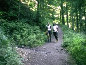
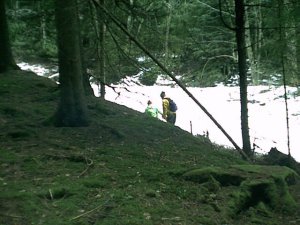
In
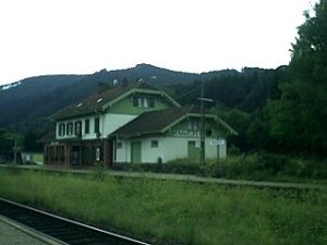
Freiburg we are at the southern Black Forest. This area
is heavily marketed for tourism. However, the tourists
never stray from the main sight, so on Hikes like this
one, you will be spared with meeting hoards of people
trampling on the same path as you. The three of us went
on a documented hike in late summer (August 2000). We
caught the train from Freiburg Hbf (main train station)
to Hinterzarten, a village, which lies at about 893m... |
|
|
B l a c k f o r e s t
-
Hinterzarten
to Himmelreich - 12km |
 |
In
Freiburg we are at the southern Black Forest. This area
is heavily marketed for tourism. However, the tourists
never stray from the main sight, so on Hikes like this
one, you will be spared with meeting hoards of people
trampling on the same path as you. The three of us went
on a documented hike in late summer (August 2000). We
caught the train from Freiburg Hbf (main train station)
to Hinterzarten, a village, which lies at about 893m.
|
 |
 |
|
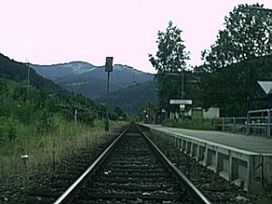
Took
about 20min and for visitors there are DM 10,-- Day
tickets (on Sat & Sun valid for 2 Adults and 2
Children) trains to the Black Forest run every
half-hour. We chose to
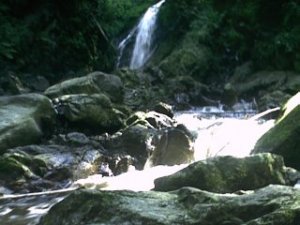
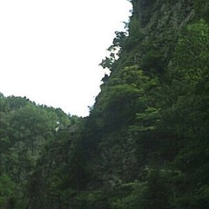
visit the "Ravenna Schlucht" (a local gorge
with a picturesque waterfall) and a hike down to
"Himmelreich" (c.a. 450m) train station via
Hell Valley (Höllental). All up, it is about 16km
downhill on a medium track (not too rough, requiring
firm boots though). From Hinterzarten to Himmelreich
(Heavens) via Ravenna Schlucht and Höllental, the
hiking path is marked with a number of signs. |
 |
 |
 |
 |
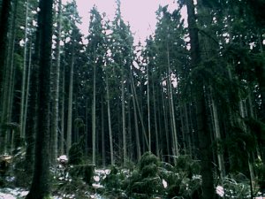
You
are best served with a Hiking map, as printed by the
Government Surveying department of Baden Wuerttemberg
supported by the Black Forest Club (Schwarzwaldverein e.
V.). Take Blatt 25 (as shown on the left frame), for the
Feldberg, Belchen and Schluchsee region..
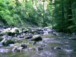
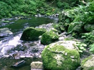
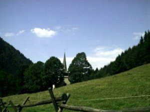
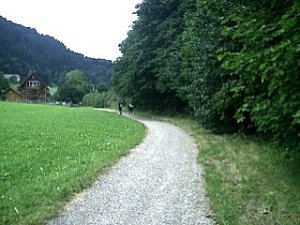
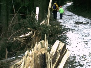
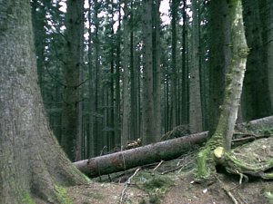
This walk takes you across green farming fields, through
dense forest (or what is left of it) along a stream
which transforms into a waterfall and brings water to
the valley.
|
|
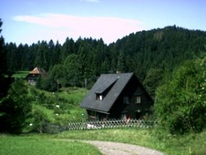
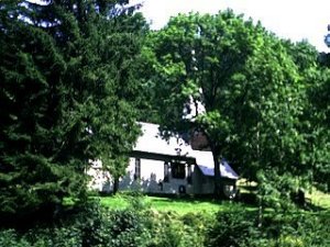
You
will pass little "Kapellen", which are just
big enough for a hand full of people if not less. These
used to be visited by passing hiker folk. Nowadays, some
of these shelters are being left to the weather and the
more prominent ones enjoy the maintenance care of their
counties. On the main strip called the hunter’s path
(Jaegerpfad) you will walk along the B31(Autobahn).
|
 |
 |
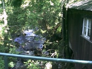
However,
for two thirds of the way the B31 will only be barely
visible through the dense shrub and forest. The soothing
sound of the Hell brook (Hoellenbach) or Rotbach will
accompany your walk. Depending on the time of the year
you will also be able to see an abundance of
wildflowers/berries and insects/butterflies.
|
 |
 |
|
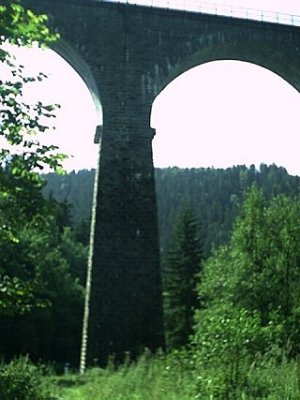
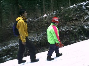
The
main tourist sight between the start of the hunter’s
path and the Heavens is the "Hirschsprung".
The story goes that during a hunt the chased dear
managed to jump across a gorge (700m to the ground) and
survived it and the hunt. In winter you will have to be
cautious, because of the ice and snow. The hunter’s
path does not receive maintenance during the winter
months and is therefore quite dangerous to walk on,
especially at the highest and narrowest point on
"Falkensteig" from which you can look into
Himmelreich.
|
 |
 |
 |
 |
Once
you have reached Himmelreich you are at the end of the
journey. The train will arrive and take you to the city,
where you can relax at a café with a nice cup of tea
and a piece of your favourite cake (for people on diet:
try the Altstadt Café in Freiburg's Gerberau 12, they
have whole meal cakes that actually taste great).
|
 |
 |
|
B l a c k f o r
e s t
- Titisee
Circuit Walk 1hr & Titisee- Saig - 2 1/2 hours |
 |
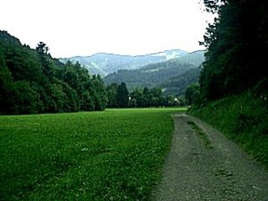
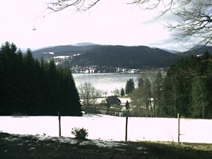
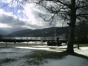
Still
in the Black Forest, we visit the Titisee (the Titi
Lake). Yes, you may laugh now. I am not quite sure where
the name comes from but I will research it for you (and
for me). If anyone knows, please email it or enter it
into the guest book, so we can unravel the mystery. The
Titisee (846m) is a lake with a 10km circumference,
surrounded by pine forests on mountains. From Freiburg
to Titisee, it takes about 30-45 minutes by train.
|
 |
 |
|
An
easy walk around it takes about 1hour. Titisee is a busy
tourist place, full of sight anxious, souvenir buying
people from all over the continent. They explore the
area by wandering from one cuckoo clock shop to another
until, they are so exhausted, that they have to rest in
one of the numerously present restaurants, which serve
creamy and buttery German dishes. A well rounded day for
some, but not for me. Whoever, thinks alike follow me:
|
 |
 |
 |
 |
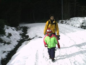
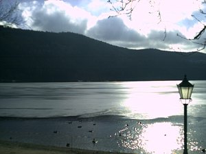
The
Titisee circuit walk is good at any time of the year. In
winter you will experience the beauty of the icy lake
surrounded by snow topped mountains. In summer the shore
of the lake will offer you a colourful display of
wildflowers, bees and butterflies, while enjoy the
shade, which the pines provide for you, the moss and the
blueberries. The area offers an abundance of adjoining
hiking paths and circuit walks. One of these is the walk
up to the "Saig" (988m), a nearby hill. During
winter the climb up may be difficult. The locals use the
first stretch for tobogganing. |
|
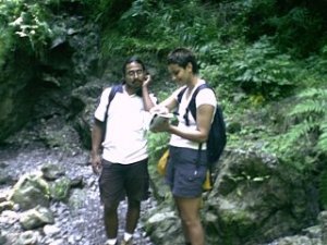
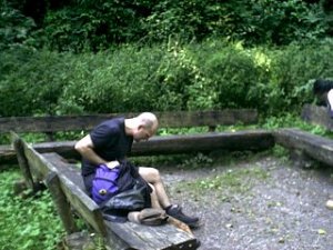
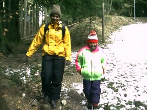
The
rest of the way is quite steep, so suitable shoes are
recommend. As you may see from the photos we also
dragged my little cousin along (Nintendo-TV generation).
I think she even enjoyed the little excursion. Anyway,
once you reach the top you can rest at a
"Gasthaus", an Inn. The prices are reasonable
and the menu contains a good selection of traditional
cuisine. Apparently, on a clear day, you can see the
Swiss Alps from the restaurant windows. What more would
you want.
|
 |
 |
 |
|
Last
edited 19-06-01
All
photos by A. Goss & S. Goss
©
A.Goss, April 2001 |
|
|